Venable Lake Loop
Stone Mountain Park | Atlanta, Georgia
Getting Their
Location
Detail
Being that it’s inside Stone Mountain Park you will have to pay $20 to get in by car, or $40 for an annual pass, which is a no-brainer especially if you’re a local.
There are two ways to get to the trailhead depending on which entrance you enter from. From the main entrance turn left onto Stonewall Jackson Dr and travel until it ends at Robert E Lee Blvd. From the East entrance go right and drive past the parking lot for the mountain top trail and travel down Robert E Lee boulevard until you reach the parking lot at the corner with Stonewall Jackson drive.
- Daily Parking Fee: $20
- Annual Parking Fee: $40
- Parking Surface : Paved
- Parking Quantity: Plenty
What to Expect
Trail
Details
One of the nice features you’ll find on most of the trails in Stone Mountain are the abundant trail markings here we’ll see a white vertical marking indicating we are on the Cherokee Trail the other half of the loop will be orange indicating a ‘connecting trail’. While that’s a nice feature of this trail we run into one of the hazards, the roots. We’ll see several patches of exposed roots on this trail so you’ll definitely have to be aware of where you’re stepping especially if you plan on running.
The Numbers
- Distance: 1.7m (2.73km)
- Elevation Change: 85ft (25.9m)
- Time to traverse: <1 hour
- Number of assents: 7 small hills
The Positives
- Almost always by the water
- Great view of Stone Mountain
- Several small water falls
- Several great photo spots
- Abundant wildlife
The Negatives
- Lots of exposed roots on the path
- Running water over bare granite
- A couple of stream crossing without a bridge
- Perpetual mud in some places
- Typical metropolitan sound scape
Virtual Tours
Trail
Videos
Check out our review and full recording videos below. We plan on having full trail records from multiple times in the year so you can enjoy a trail from your favorite season or see how much things change through out the year!
Full Review
Text
Review
The Venable Lake Loop is a little tucked away trail that’s part of the larger Cherokee Trail which encompasses all Stone Mountain here just outside of Atlanta Georgia. This loop is just one of almost a dozen trails in the park. If you haven’t been to Stone Mountain or have only been on the trail that goes to the top of the mountain I encourage you to check all the other trails out. I’ll try to review all of them over the course of the next few months.
Today though let’s explore this little-known loop. Being that it’s inside Stone Mountain Park you will have to pay $20 to get in by car, or $40 for an annual pass, which is a no brainer especially if you’re a local. To get to the trail head you’ll have to drive past the main parking lot for the mountain top trail and travel down Robert E Lee boulevard until you reach the parking lot at the corner with Stonewall Jackson drive.
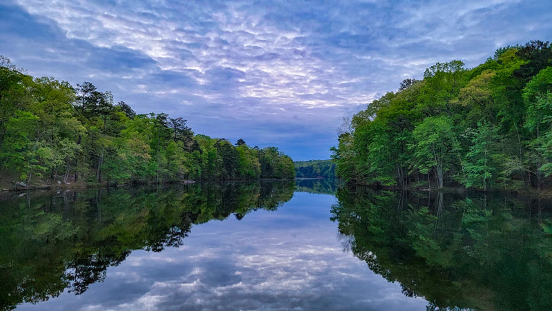
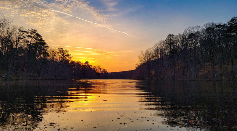
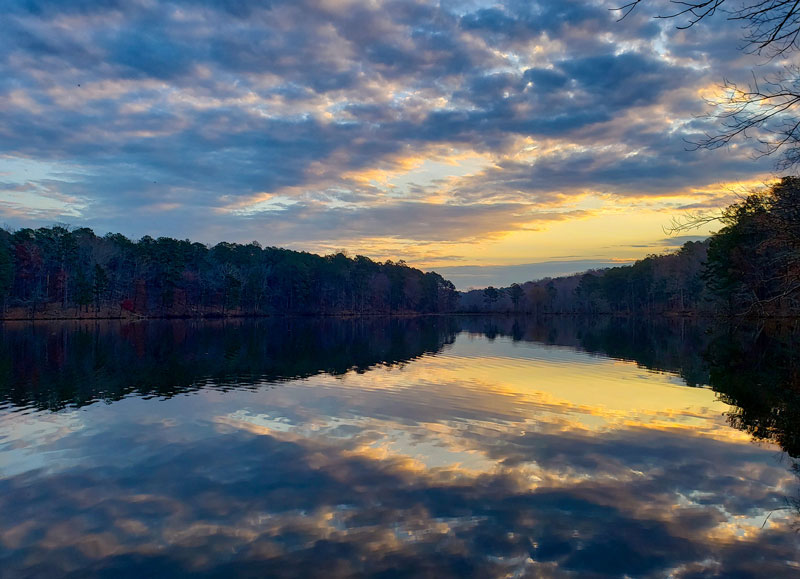
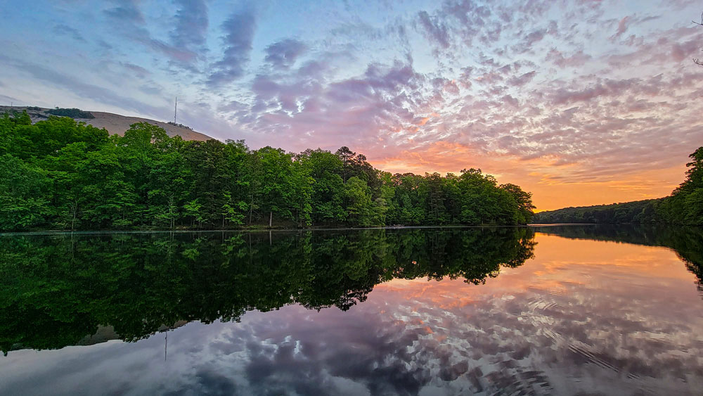
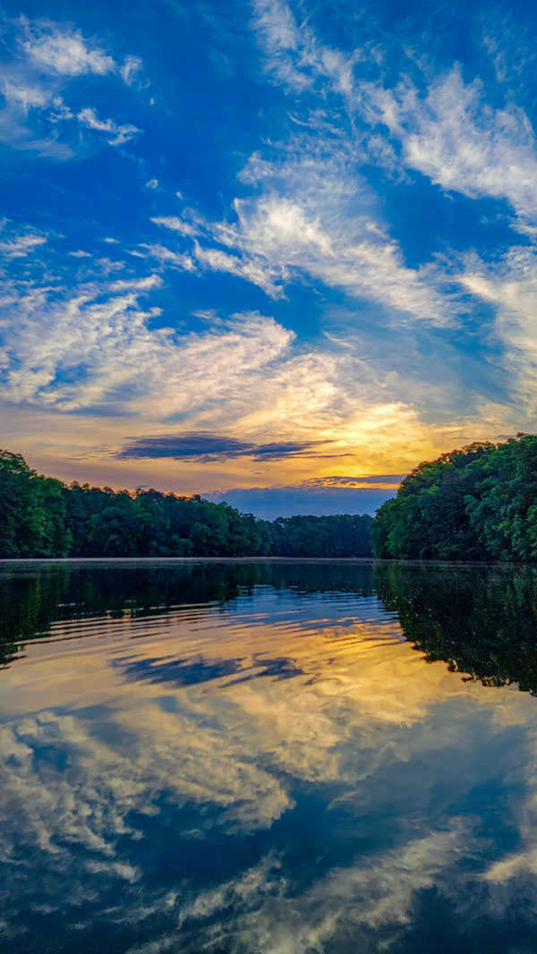
Depending on which way you want to go you can hop on the trailhead directly across from the parking lot or cross the bridge and get on from the other side. Since I’m weird I’ll be going counterclockwise and crossing the bridge first. Right off the bat the view you get from bridge of Venable Lake is pristine, just imagine it at sunrise with a little overcast. Actually you don’t have to imagine here are some pictures I took! I love coming here to watch the sunrise and this isn’t the only spot with a nice vista even on this short loop which comes in at 1.7 miles so it should take roughly an hour to complete.
As mentioned his half of the loop is also part of the 4 mile Cherokee Trail that goes all around the park. One of the nice features you’ll find on most of the trails in Stone Mountain are the abundant trail markings here we’ll see a white vertical marking indicating we are on the Cherokee Trail the other half of the loop will be orange indicating a ‘connecting trail’. While that’s a nice feature of this trail we run into one of the hazards, the roots. We’ll see several patches of exposed roots on this trail so you’ll definitely have to be aware of where you’re stepping especially if you plan on running.
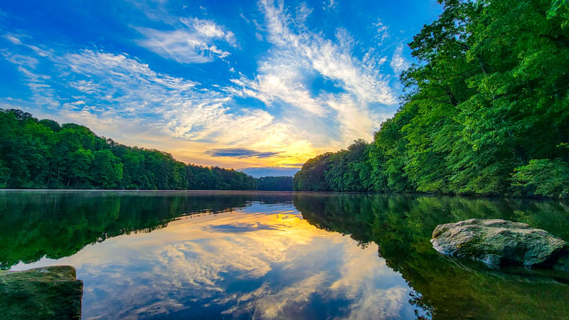
One of the things I love about this trail is how close you get to the water and that you’re really never that far away from it. Depending on the time of year you can see geese, blue herons, and even the occasion otter swimming in the lake. Coming up is one of my favorite places to stop and take pictures or just enjoy the vista. This log in the mud is the marker, from here you get an amazing view of lake, tree line, and Stone Mountain itself. Again depending what time of day you go you can get some amazing shots from this spot, let’s remove this fog for a sec so you can see what to expect. These are just a couple of pictures I’ve taken from right here. I will never get tired of a partly cloudy sunrise, simply majestic.
Moving on, while this trail is relatively flat with only 85 feet of total elevation change there actually are several hills we’ll be traversing making it a decent work out for most.
As you’ll notice you almost always have a sight line with the lake but again watch your step with the roots.
While we’re on the way to next spot just a few points about the trail, it is pet friendly, so definitely bring your doggos out here, they’ll love it, mine sure does! No biking is allowed on this part of trail, but as you saw at the beginning the road around Stone Mountain is perfect for biking, jogging, or running which is a great alternative if for instance a heavy rain bogged down the trail which does happen on occasion.
As we venture into the interior we find a smallish stream and waterfall. While the waterfall is lovely we do run into another one of the particulars of this trail. You’ll have to make a little jump to get to the other side and depending on how much its rained recently that jump could be a small one or a large one. So I highly recommend making sure you have proper hiking shoes because running water on bear stone is not a good mix for a walking jumping human. Just watch your step and you should be fine.
Heading back down toward the lake there are several off shoots that get closer to water and provide more spots for photos, I’ll stick to the official trail for now but I definitely encourage you to explore and get those shots!
Let’s continue, another note about Stone Mountain in general, since the park is basically in the center of a major metropolitan area and relatively close to the busiest airport in the world you’ll hear the occasional fly over from jets and helicopters, the in and out of sirens especially from the neighboring highway, and most annoyingly of all the conversations from people on the loop road who think the entire galaxy cares what their psychic told them yesterday. Seriously though I recorded this trail three times and in everyone I can clearly hear conversations people are having from the road across the lake….but I digress.
Thankful as we get close to my next favorite spot they all get drowned out anyway. Luckily they did build a nice bridge over this gap coming up. Before the bridge though there is this marker indicating the entrance to a connecting trail on the right that leads to the Atlanta Evergreen Marriott. It’s a nice short point 6 mile trail which on it’s own has some great vistas. I’ll probably visit it in another trail review video.
Over the bridge we go and to the right is an off shoot that I will take because it’s awesome. At the end of this peninsula there is a perfect resting spot to sit and enjoy the view while listening to the running water right beside you. This is another good spot for photos. This body of water is actually part of the much larger Stone Mountain Lake.
At this point we are roughly midway through the loop. Heading back to the trail we walk between both lakes. Again there are several off shoots on both sides where you can get closer to the water for some different perspectives.
At the end of this path we’ll hit a fork, going to the right will continue on with the Cherokee Trail. We’ll be heading left to get onto the second half of the loop. Right away we see the marker is now orange, which again is just telling us we are on a connecting trail for the full Cherokee Trail. This side of the loop is similar to the last but it is less traveled for the most part, not sure why.
A little ways in there are the remnants of an old granite chimney that used to belong to a long gone house. I’ll pop up the accompanying plaque on the screen so if you’d like to pause the video to read it you can.
Heading on we come across another gap with a small stream where you just need to watch your step to jump across.
As you may have noticed this half of the loop is relatively flatter compared to the first half but the views of the water are just as nice.
Around the corner we have a slightly larger example of flowing water over bear stone, I would simply advice going across the top where it’s level to get to the other side. Unless it hasn’t rained for more than a week this area will always be a little boggy which is true is for several parts of the trail here and around the park. None the less between the bogs are great views.
At the start of this small inlet is probably the most precarious section of the trail. The stream starts higher up near the road and spreads out as it comes down hill making for a wide marshy area. Again depending how much it’s rained there could be several ways to get across. I took this small jump at the bottom and then hopped on a log to get to the other side but when you’re here there could be any number of other ways to get across. It’s all about watching where you step.
The last quarter of the trail is quite tranquil with a lot of spots to sit down right on the edge of the lake and enjoy the view, maybe do some fishing if you’re so inclined. I most enjoy the spots where there are smooth rock shores, this are great spots to sit or lay down without being directly on the dirt or mud.
Again I just love how we are always close to the water, it’s one of my favorite things about this trail and the larger Cherokee Trail, although the ladder does have stretches where you’re not near any water.
We get one more bridge crossing over a stream which is honestly just a storm water drain outlet but nevertheless, it’s nice that they made the two bridges over the larger streams like this one but some of the other parts of the trail that are almost perpetually bogged down could use something to help people get across, of course doing some parkour is part of the fun.
Entering the final stretch the bridge we crossed at the beginning comes into clear view. We have one last jump across the gap, again just watch your step and you should be fine.
At the top of the hill we cross the road to end up back in the parking lot where we started and that’s it.
I hope you enjoyed this trail review! I also hope that you get the opportunity to try out the trail for yourself! Look forward for a full recording and review of the whole Cherokee Trail sometime soon.