
Laurel Ridge Trail loops through the Army Corps of Engineers parks at the south end of Lake Lanier, right beside Buford Dam. It has a bit of everything: the lakeshore and a beach, woods full of ferns, a stream valley, the Chattahoochee where it leaves the dam, and the dam itself, with a few goats keeping the grass down on its face.
It is one of my favorite trails, and it is also one where I have had to help more than one group find their way. The markings are mixed, the loop runs through parking lots and picnic areas where the path is easy to lose, and one branch has been cut off by a fallen tree for years. This page shows where those spots are.
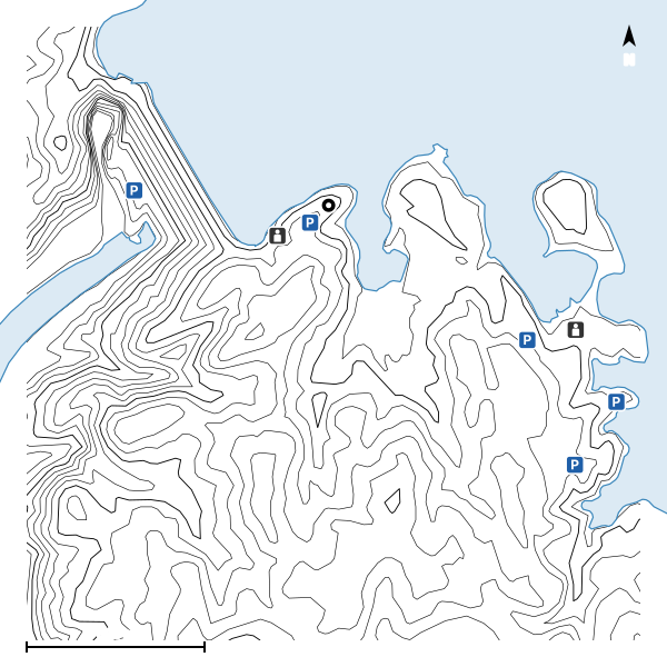
I first reviewed this trail here in August 2021, and this page replaces that review. I walked the loop again on October 9, 2026, clockwise from Lower Overlook, so the map and the numbers below come from that recording.
Getting There
Location Detail
The trailhead is the Lower Overlook lot, on the lake side of Buford Dam just east of the dam itself, off Buford Dam Road. Parking there is free. Despite the name, Upper Overlook is behind a gate with a Restricted sign and is not open to the public, so this is the lot. The trail leaves from the end of the lot between two stone pillars with a No Bicycles sign. You can also join the loop from the lots in Buford Dam Park, at the beach and the fishing pier, or from Lower Pool at the foot of the dam, but Buford Dam Park is one of the Corps' day-use parks and charges a fee. I walk it clockwise, so the lake comes first and the dam last.
Open the lot in Google Maps. The pin is where the walk on the map began.
What to Expect
Trail Details
The trail changes a lot over one loop. It starts out nice and wide, easily two or three people side by side, through the woods above the lake. After the first road crossing it gets a little more technical, with exposed roots and bare granite that is slippery when wet. Around the beach it turns into the concrete paths of the park, and that is where it is easiest to lose. The second half is a narrow, rocky path through a power easement, a busy road, and a quick drop down a stream valley with a few small bridges to the Chattahoochee below the dam. The last stretch crosses the river on a new bridge, passes the dam and climbs the stairs beside it back up to the road. The markers are brown posts with a hiker on them, and they are mixed: some stretches are well marked and some have nothing. There are no painted blazes to follow, as there are at Stone Mountain. I saw two paint marks on trees the whole way round, and they did not look official.
Not long after the start, a short branch goes off to the left into the lushest part of the trail, all ferns, like the forest moon of Endor. The little bridge into it was taken out by a fallen tree many years ago and has never been rebuilt, so that section is all but abandoned unless you want to jump the gap, which can be treacherous. The way around is a makeshift path into a power easement and then along the road to where the branch used to come out. That end has a Restricted Area sign, and you walk past the automatic gate to a crosswalk, where the proper trail picks up again on the other side.
The place most people get lost is the beach. The path turns to concrete as you come down to the level of the lake, and then it runs out into a field that usually serves as a soccer field. Keep walking ahead along the shoreline, around the little peninsula lined with benches and grills, and walk behind the basketball court and the volleyball court; the trail goes downhill to the left from there. It is not well marked through here, so keep an eye out.
At the fishing pier lot, go straight across the lot and you will find the same markers on the other side. Past the long bridge there is a split: the trail goes right, and straight on, down the hill and to the left, is a small observation deck out over the water. At the hilltop lot with the three big picnic shelters there are no markers until you are back on the trail, so walk the edge of the lot to find it.
The end is the best part, which is why I walk it clockwise. The trail follows the stream down to the Chattahoochee where it leaves the dam and stays well above the water. The long bridge across the river has finally been rebuilt, and it is brand new. A little further on, an arched footbridge crosses the channel from the powerhouse, and from the far side you can look up it to the outlets where the water is released. Goats keep the grass down on the face of the dam, since it is too steep to mow. They are inside the restricted area around the dam, so you see them from a distance, and that morning a big flock of geese was on the dam too. Then it is the stairs beside the dam, 65 steps by my count, and the rest of the climb back up to the road without them.
The Numbers
The Positives
The Negatives
Underfoot
On the Trail
What the trail itself is like, in the order the walk reaches it.
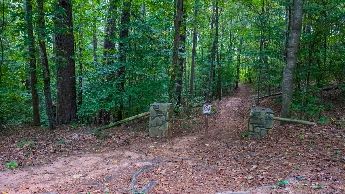
October 9, 2026, 7:43 AM, mile 0.2. The trailhead at Lower Overlook, between two stone pillars with a No Bicycles sign.
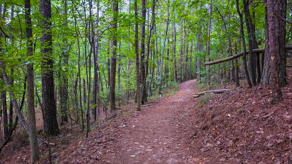
October 9, 2026, 7:46 AM, mile 0.3. The first stretch, wide enough for two or three side by side.
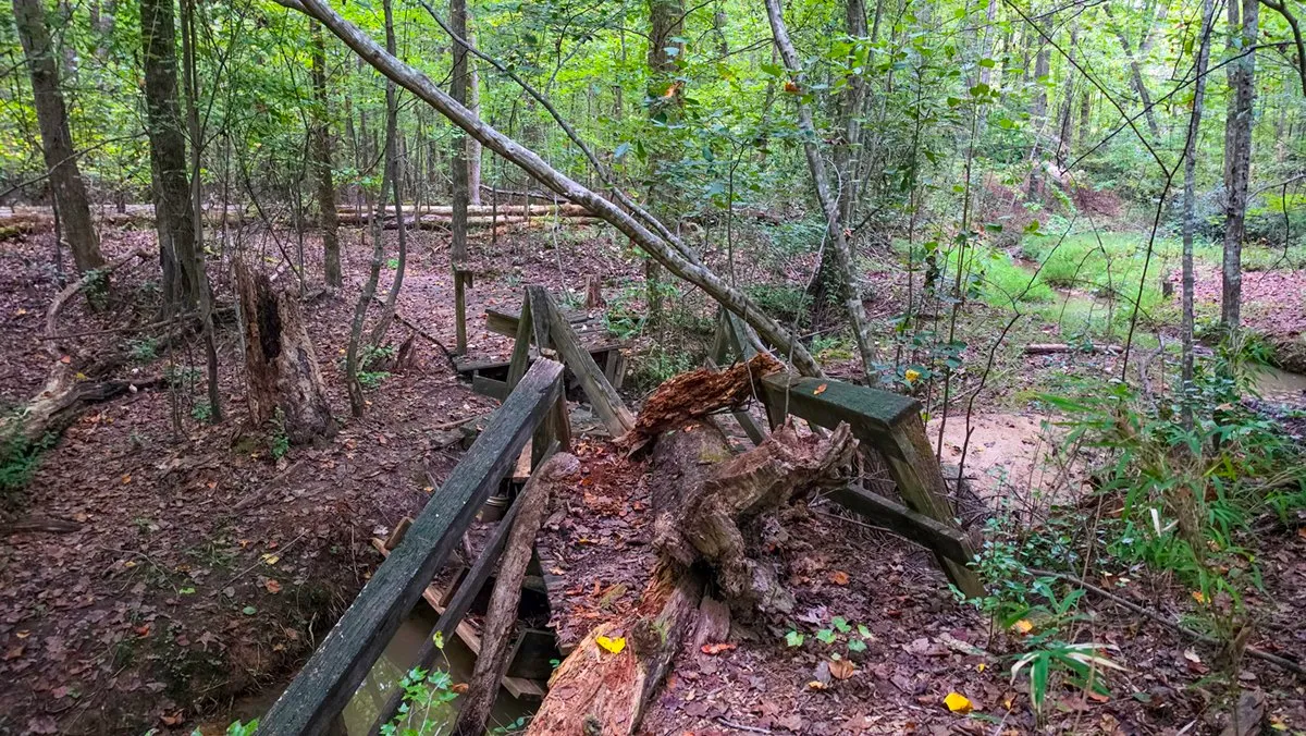
October 9, 2026, 7:51 AM, mile 0.5. The little bridge into the ferny branch, taken out by a fallen tree years ago and never rebuilt.
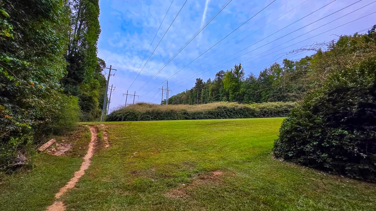
October 9, 2026, 7:52 AM, mile 0.6. The way around it, a makeshift path into the power easement.
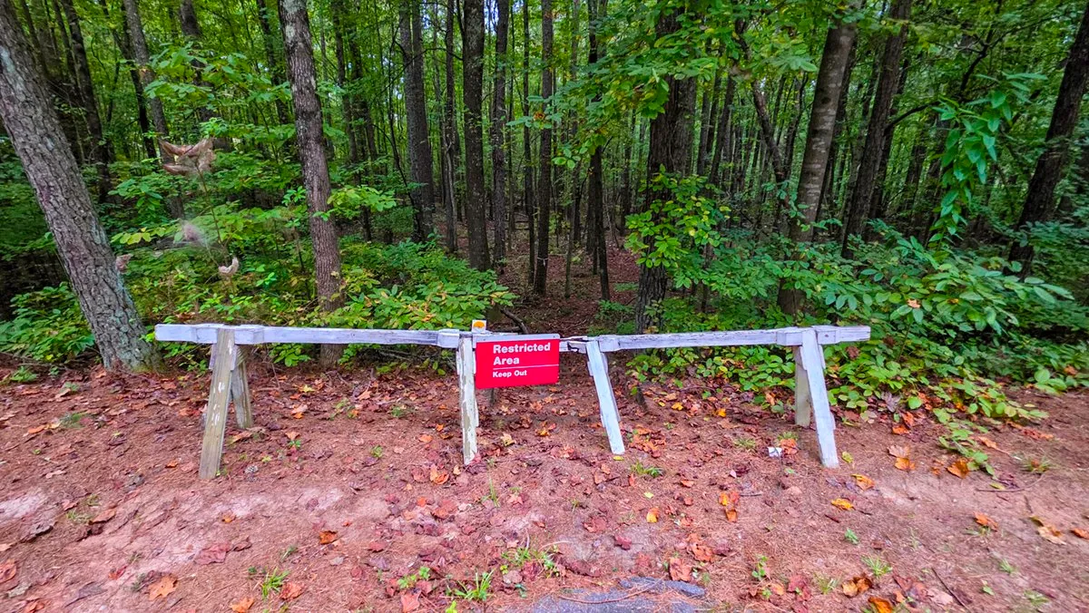
October 9, 2026, 7:55 AM, mile 0.7. Where the cut-off branch comes out, a Restricted Area sign by the automatic gate.
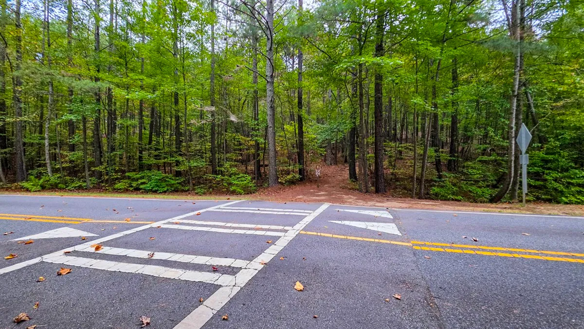
October 9, 2026, 7:55 AM, mile 0.7. The crosswalk where the proper trail picks up again on the other side.
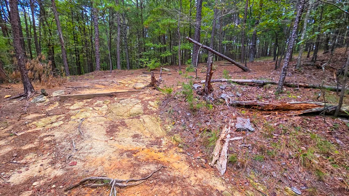
October 9, 2026, 7:57 AM, mile 0.8. Past the road it gets more technical, with roots and bare granite that is slippery when wet.
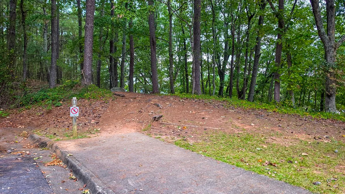
October 9, 2026, 8:07 AM, mile 1.3. The trail post at the overflow lot by the beach, often closed, where you can also join the loop.
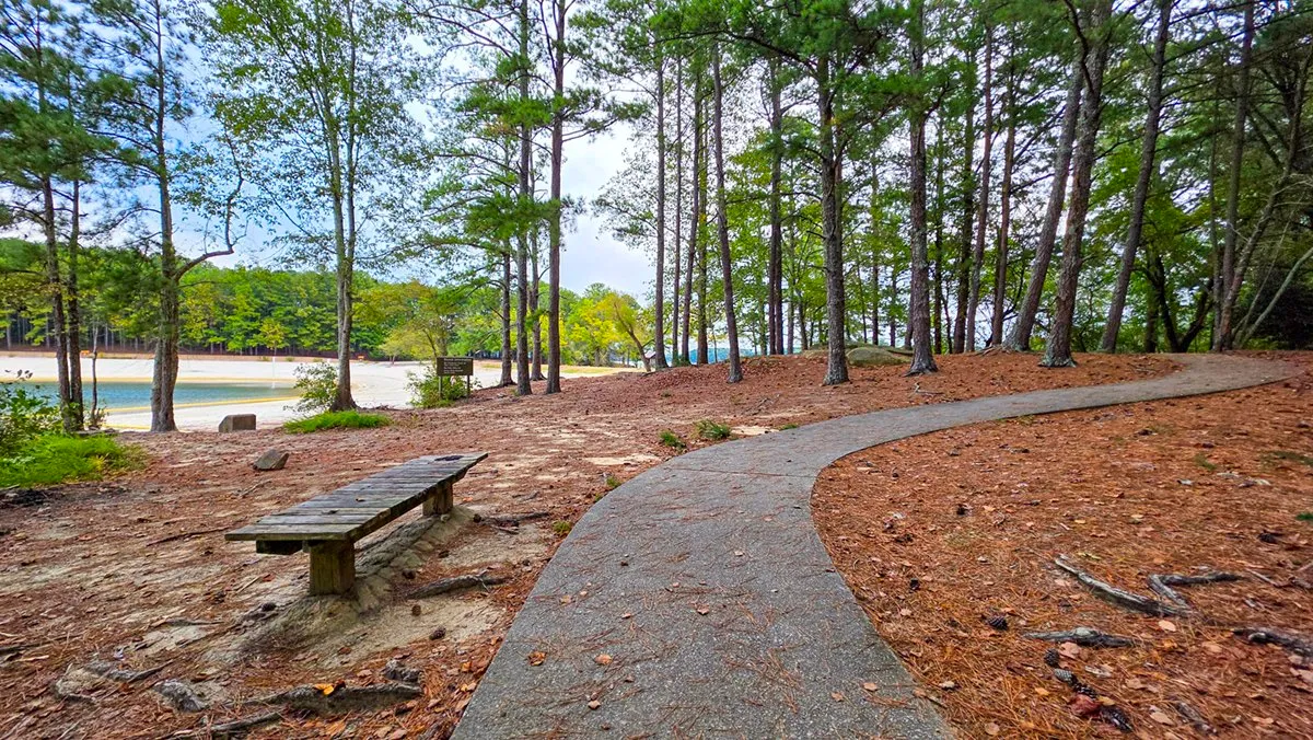
October 9, 2026, 8:10 AM, mile 1.4. Down at the level of the lake the path turns to concrete. This is where most people lose it.
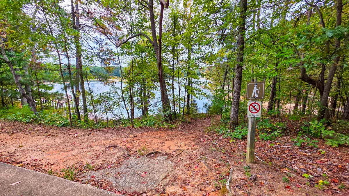
October 9, 2026, 8:19 AM, mile 1.9. At the fishing pier lot, go straight across and the posts pick up again on the other side.
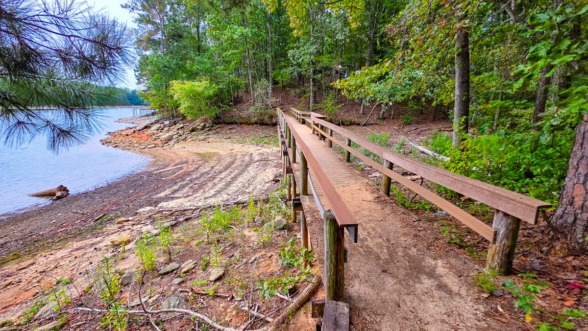
October 9, 2026, 8:21 AM, mile 2.0. The long bridge along the shore. With the lake this low it stands over bare ground.
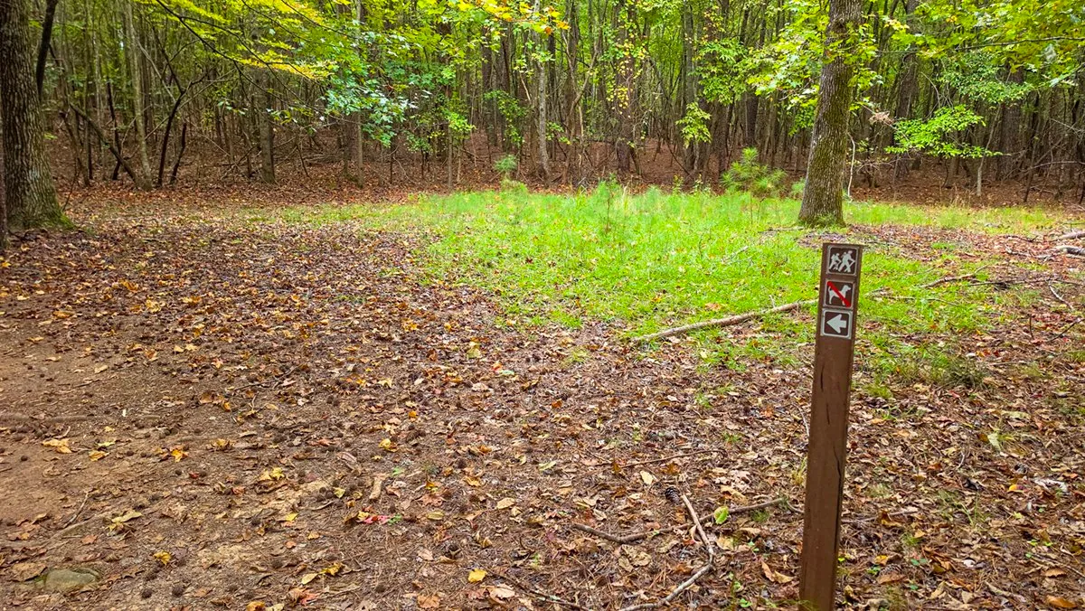
October 9, 2026, 8:29 AM, mile 2.2. The first post past the picnic shelters, with hikers, no dogs and the arrow back onto the trail.
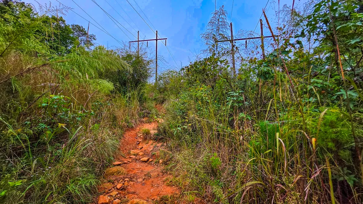
October 9, 2026, 8:37 AM, mile 2.6. The narrow, rocky path under the power lines. Check for ticks after this one.
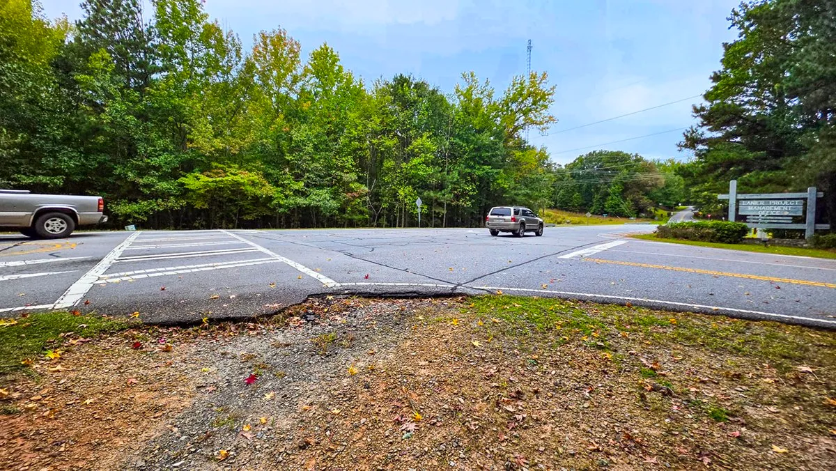
October 9, 2026, 8:45 AM, mile 2.9. The busy road crossing about halfway round.
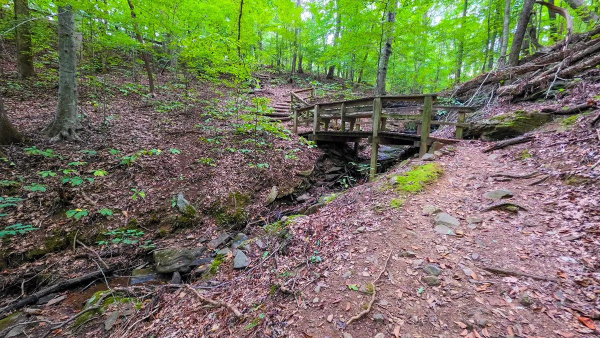
October 9, 2026, 8:50 AM, mile 3.2. One of the small bridges on the way down the stream valley.
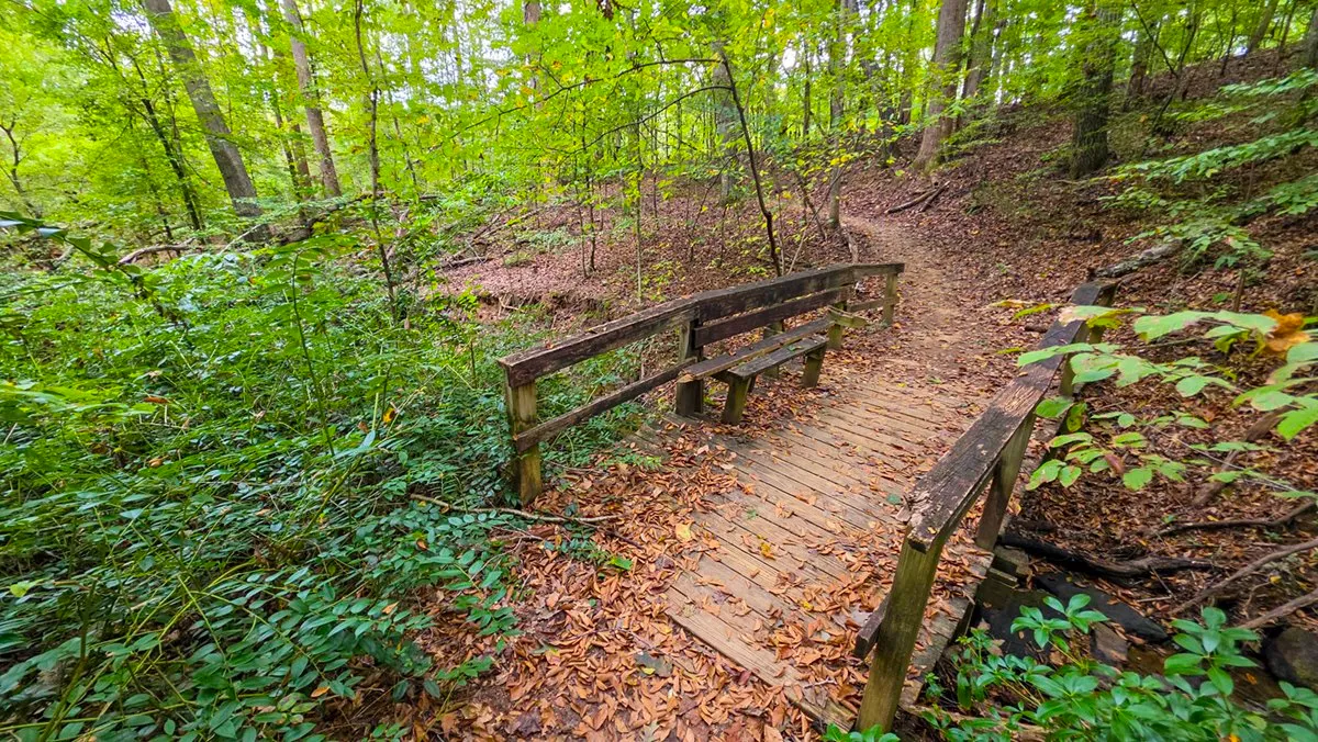
October 9, 2026, 8:56 AM, mile 3.4. A worn bridge further down, slippery when it is covered in leaves.
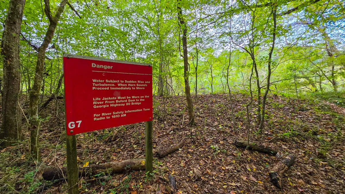
October 9, 2026, 8:59 AM, mile 3.5. The Danger sign by the river. The water below the dam can rise fast when the Corps releases it.
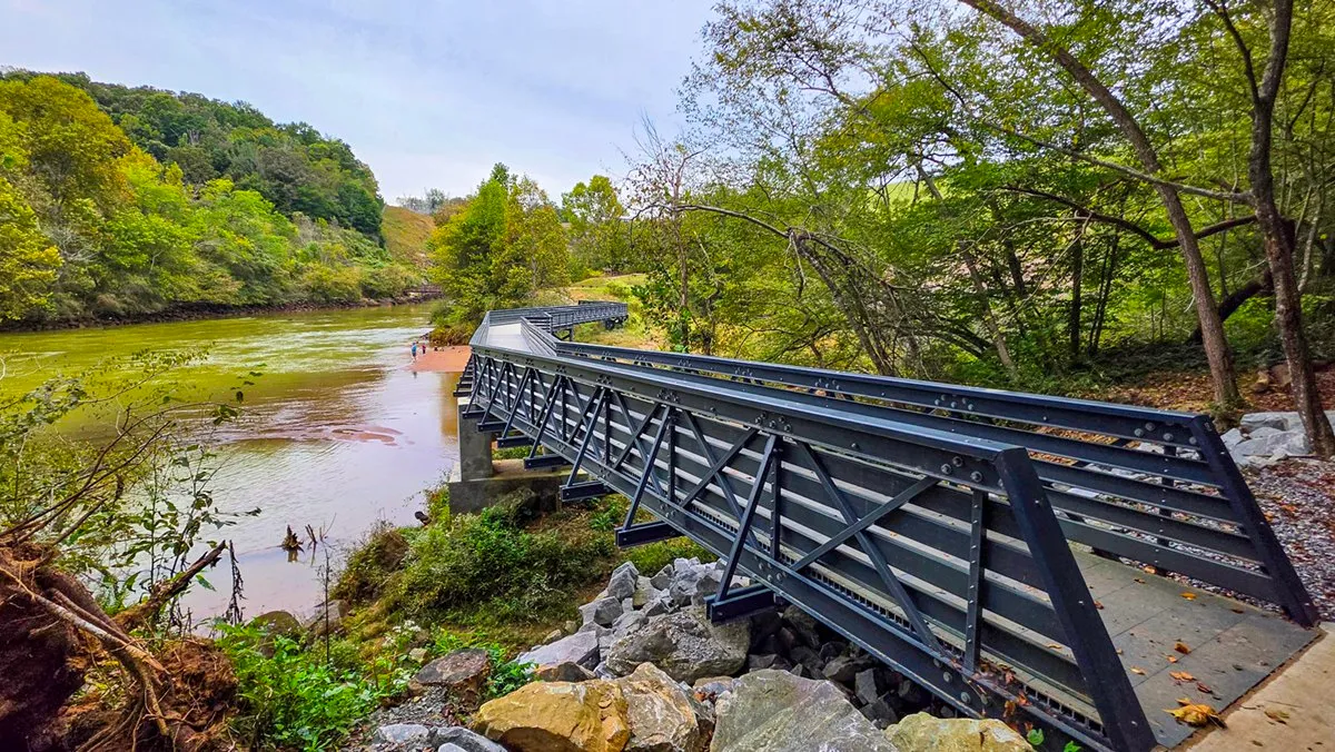
October 9, 2026, 9:05 AM, mile 3.8. The new bridge across the Chattahoochee at the foot of the dam.
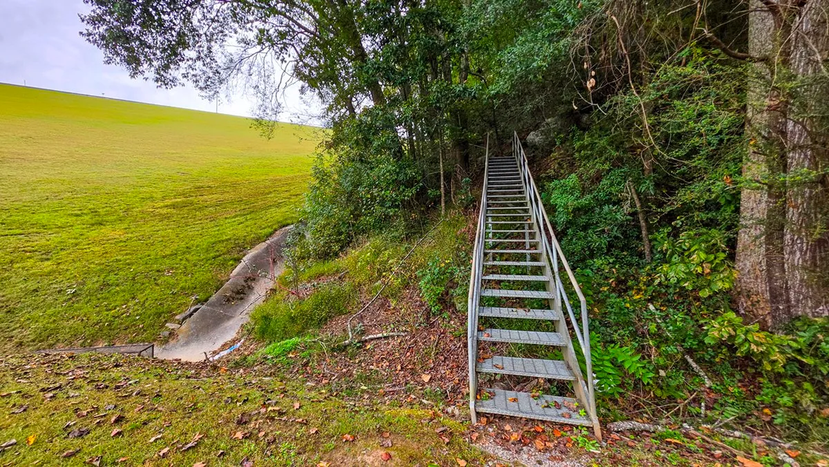
October 9, 2026, 9:23 AM, mile 4.1. The stairs beside the dam, the last climb of the loop clockwise.
From the Trail
The Views
What I stop for on the way around, each from a morning in the log.
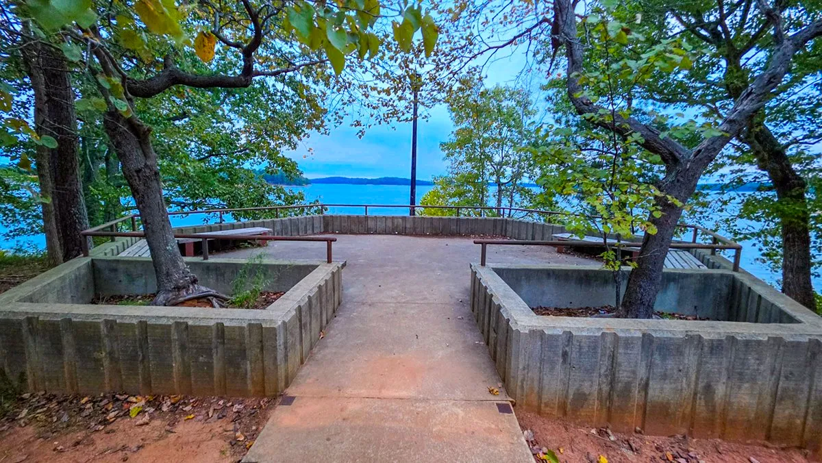
October 9, 2026, 7:39 AM, mile 0.0. The overlook at Lower Overlook, a few steps from the lot.
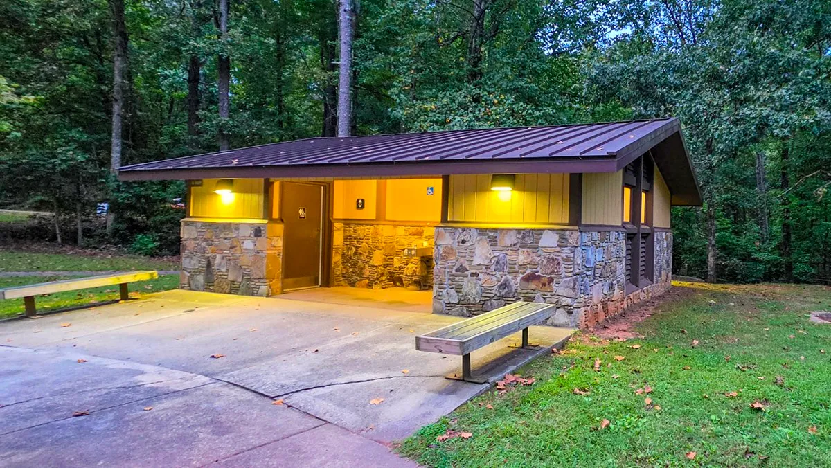
October 9, 2026, 7:41 AM, mile 0.1. The permanent restroom building at Lower Overlook.
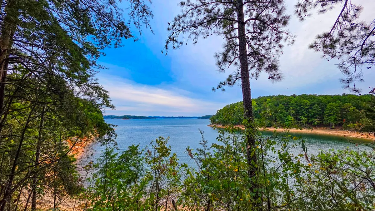
October 9, 2026, 8:04 AM, mile 1.1. The first view of the lake from the trail, with a beach across the cove. The water was low that morning.
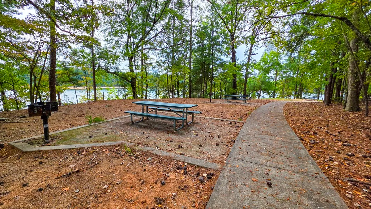
October 9, 2026, 8:13 AM, mile 1.6. Benches and grills all the way around the little peninsula by the beach.
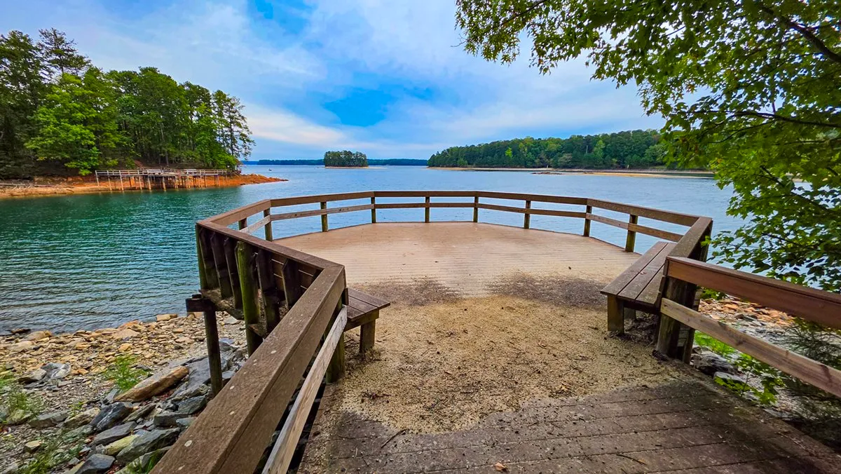
October 9, 2026, 8:24 AM, mile 2.0. The small observation deck, straight on and down the hill past the long bridge.
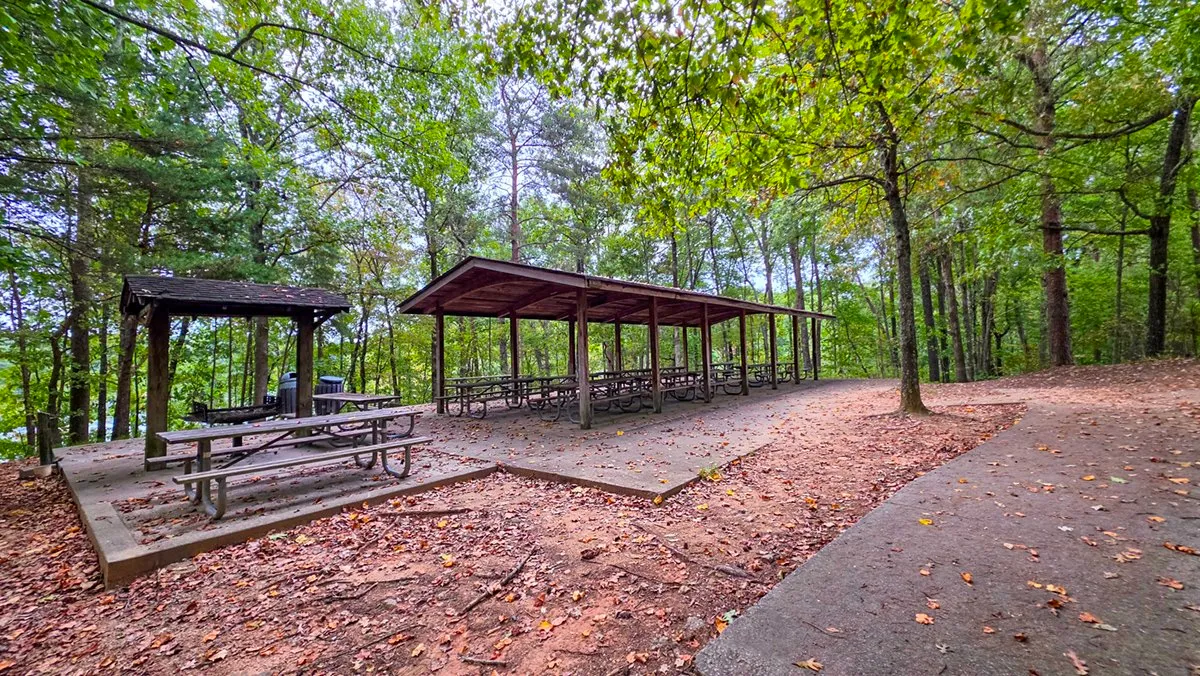
October 9, 2026, 8:26 AM, mile 2.1. The three big picnic shelters at the hilltop lot.
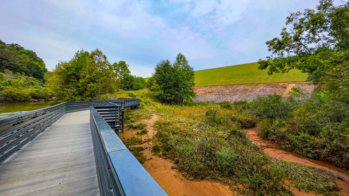
October 9, 2026, 9:05 AM, mile 3.8. From the new bridge, the river runs toward the face of Buford Dam.
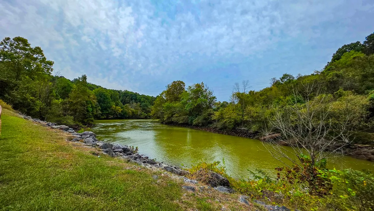
October 9, 2026, 9:11 AM, mile 3.9. The Chattahoochee below the dam, from the bank by the arched footbridge.
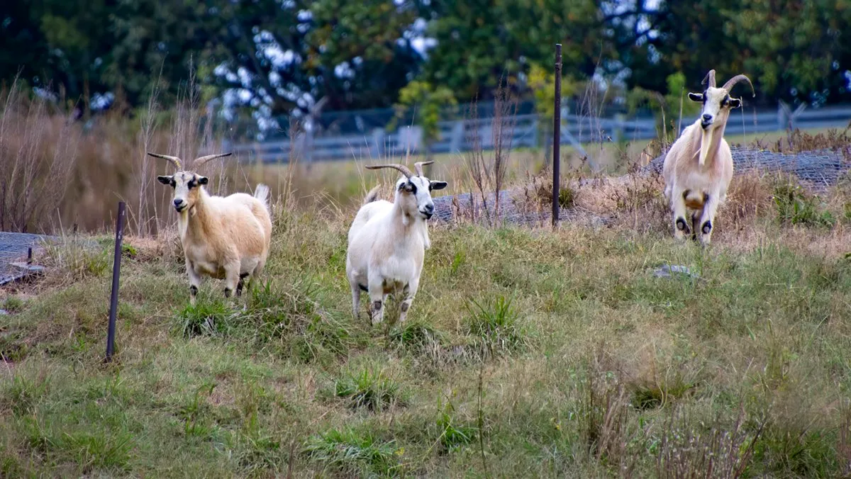
October 9, 2026, 9:19 AM. The goats that keep the grass down on the face of the dam, inside the fence of the restricted area.
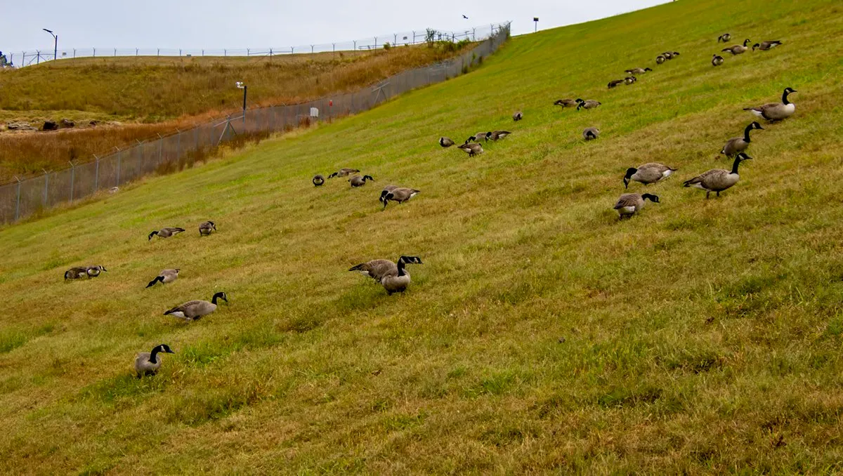
October 9, 2026, 9:21 AM, mile 4.0. Canada geese grazing on the face of the dam that morning.
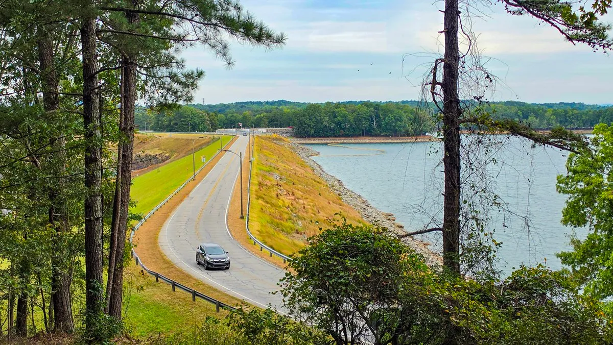
October 9, 2026, 9:31 AM, mile 4.4. Buford Dam Road along the top of the dam, with the lake on the right.
In 360
Look Around
Three places on the walk in every direction, taken with a 360 camera on a stick. Tap one, then drag to look around, up and down included.
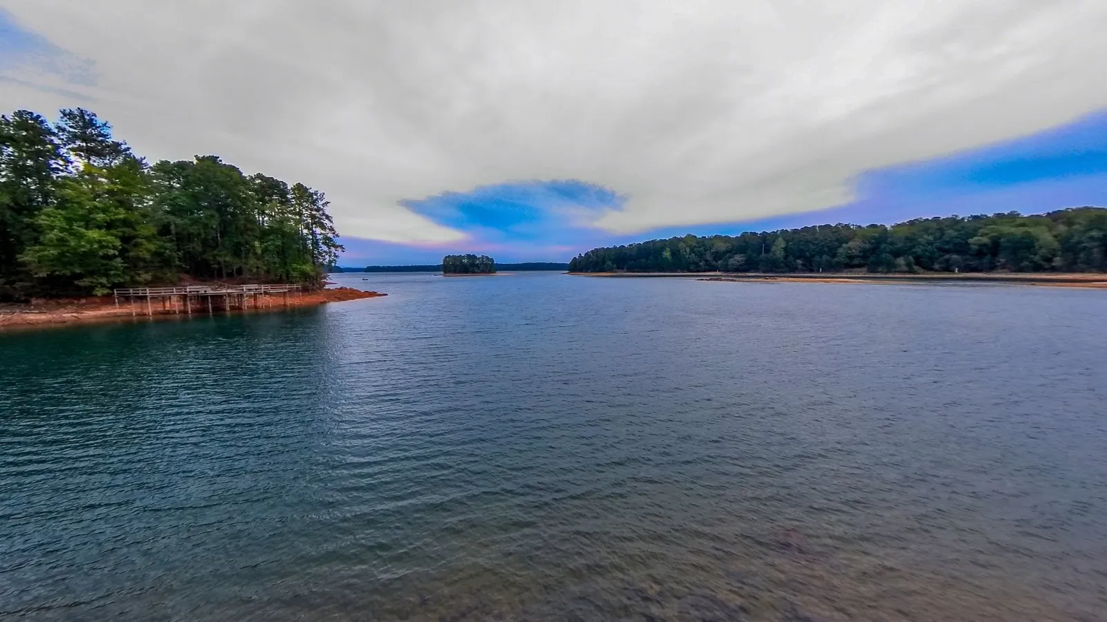
About 3.0 MB on a computer, 1.0 MB on a phone. Nothing loads until the tap.
Click the photograph, then scroll to zoom
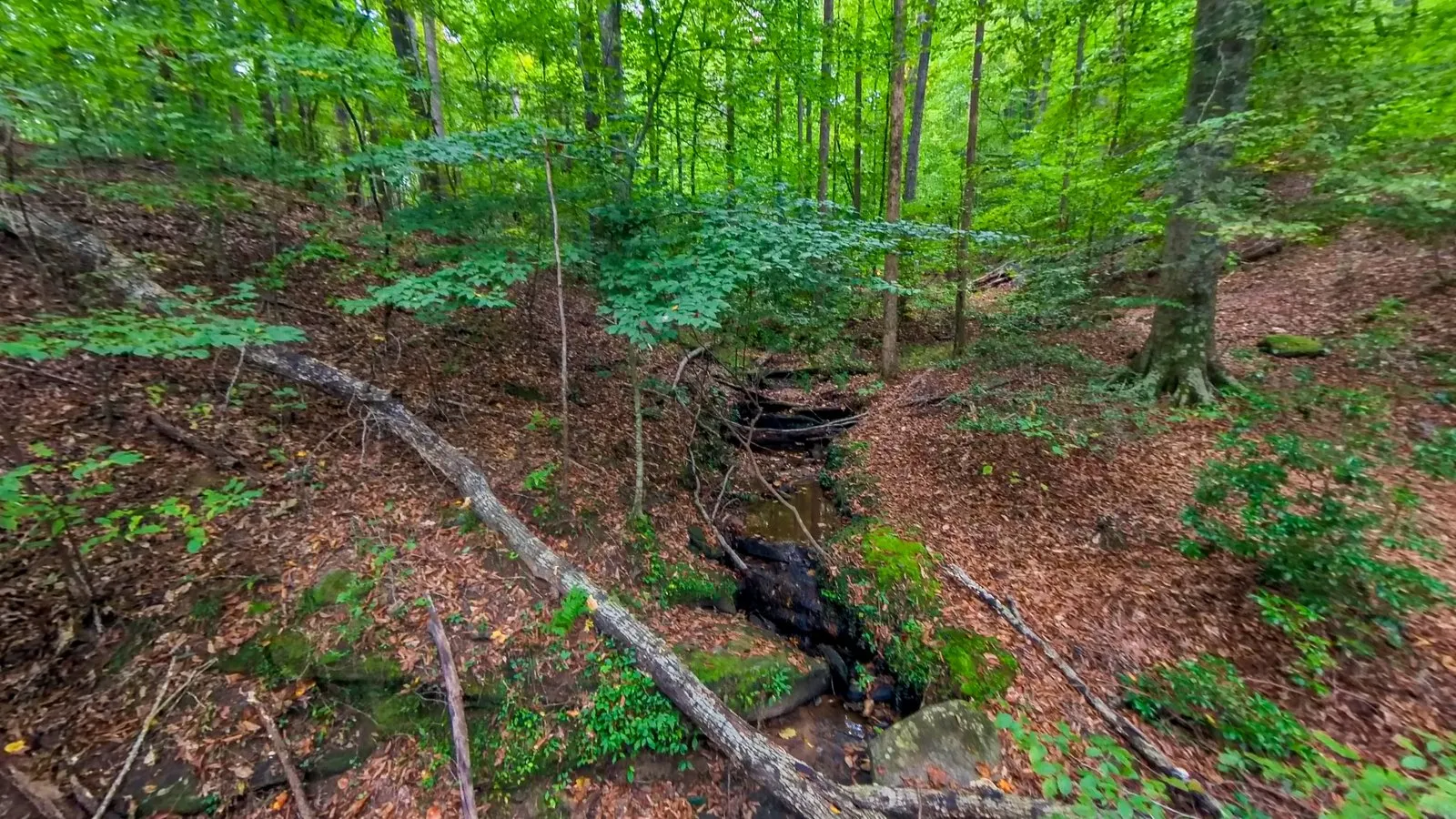
About 6.5 MB on a computer, 2.3 MB on a phone. Nothing loads until the tap.
Click the photograph, then scroll to zoom
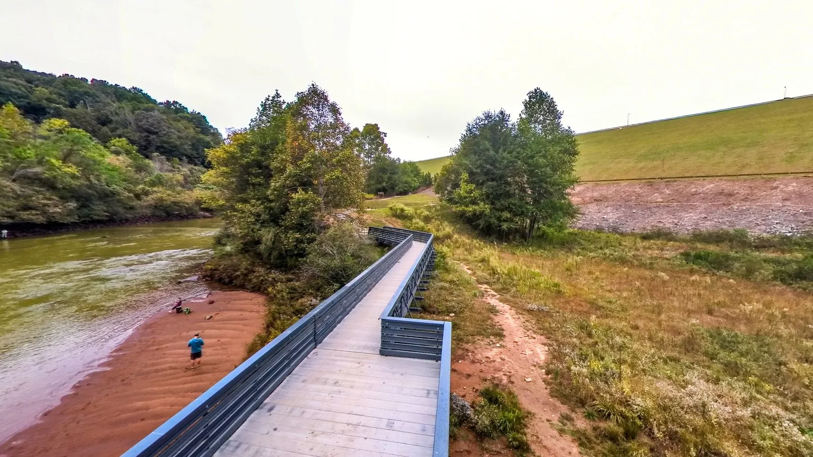
About 3.5 MB on a computer, 1.1 MB on a phone. Nothing loads until the tap.
Click the photograph, then scroll to zoom
Virtual Tour
Laurel Ridge Trail in 3D
Laurel Ridge Trail in three dimensions: turn it, tilt it, zoom in, or follow the route along the ground.
534 KB on a computer, 159 KB on a phone. Needs WebGL2 and a script; nothing loads until the tap.
Click the terrain, then scroll to zoom
From the Recording
By the Numbers
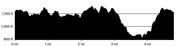
One walk, the one on the map: my recording of October 9, 2026, from where it began to where it closed, leaving out the side trip down to the observation deck, the side trip over the arch bridge to see the powerhouse outlets and the walk up toward the powerhouse for a look at the goats on the dam. The distance is the watch's track; "on the move" counts the time walked at 1 km/h or faster, so standing still for a photograph does not count, and "clock to clock" keeps the stops. The climb is read from the USGS grid, counting every rise of 10 ft or more. These are one walk's numbers, not a median over the log.
Asked Often
Questions and Answers
How long is the Laurel Ridge Trail?
4.79 miles as I walked it on October 9, 2026, about 95 minutes of walking or 106 with stops.
How much climbing is there?
557 feet in all, counting every rise of 10 feet or more on the USGS elevation grid, and 251 feet between the lowest and highest points.
Where do you park for the Laurel Ridge Trail?
At Lower Overlook, the free lot at the trailhead: 33 spaces, 1 of them accessible. Overflow: the lots in Buford Dam Park at the beach and the fishing pier, and Lower Pool at the foot of the dam, all on the loop; Buford Dam Park charges a day-use fee, and its overflow lot by the beach is often closed.
Where do people get lost on Laurel Ridge Trail?
Mostly at the beach in Buford Dam Park, where the concrete path runs out into a field. Keep going ahead along the shoreline, around the little peninsula, behind the basketball and volleyball courts, and the trail goes downhill to the left. The other spots are the fishing pier lot (go straight across) and the hilltop lot with the three picnic shelters (walk the edge of the lot until the trail picks up).
Is Laurel Ridge Trail marked?
Partly. The markers are brown posts with a hiker on them, and some stretches have plenty while others, mostly through the park and its parking lots, have none. There are no painted blazes to follow.
Which way should I walk it?
Clockwise from Lower Overlook. Many people go counterclockwise to get the stairs by the dam over with at the start, but clockwise saves the dam for the end, which is the best part.
Is there a map of Laurel Ridge Trail?
The map on this page is my own walk of the loop, clockwise from Lower Overlook, drawn over the USGS contours, with the parking lots and restrooms marked.
Why is the walk on this page longer than the distance the Corps gives?
The way around the broken bridge, through the power easement and along the road, adds to it, and so does walking around the beach peninsula to pick the trail back up. The side trips to the observation deck and over the arch bridge are left out of the map.
Are there restrooms on Laurel Ridge Trail?
There is a permanent restroom building at Lower Overlook, where the trail starts. There are restrooms at the beach in Buford Dam Park too, but they are not always open.
Is it safe near the river?
On the trail, yes. The Corps releases water from the dam and the river can rise fast, so stay off the bank, and if you hear the horn, get away from the water.
Can I bring my dog?
Not on the whole loop. The signs are inconsistent and some parts of the trail allow dogs, but the trail post by the hilltop picnic shelters in Buford Dam Park shows no dogs, and the Corps' listing for the park says pets are not allowed there. The loop runs through Buford Dam Park.
Can I ride a bike on Laurel Ridge Trail?
No. There are No Bicycles signs at the trailhead and on the trail posts.
Before You Go
A Word on the Rules
The river below the dam can rise fast. The Corps releases water from the dam, and the sign by the river says the water is subject to sudden rise and turbulence, that you should head for shore when the horn sounds, and that life jackets must be worn on the river from Buford Dam to the Georgia Highway 20 bridge. For river safety information it says to tune to 1610 AM. The trail stays well above the water, so as long as you are on it and not down on the bank, you are fine.
No bicycles. The trailhead and the trail posts say so.
Dogs are not consistent along the loop. Some parts of the trail are signed as allowing them, but the trail post by the hilltop picnic shelters in Buford Dam Park shows no dogs, and the Corps' listing for the park says pets are not allowed there. The loop runs through Buford Dam Park, so a full loop takes a dog through it.
How This Page Was Made
The Record
The words and the lists are mine. The numbers are not typed: the distance, the time and the climb are measured from my recording of October 9, 2026, cut from where the walk began to where it closed, and the elevation comes from the USGS grid, not the watch. Each photograph is from a morning in the log, placed by its own GPS or by the watch's track at the moment it was taken, as the methods page describes.
Sources
- Buford Dam Park, Recreation.gov (U.S. Army Corps of Engineers) (the park's beach, courts and restrooms, its day-use fee and its rule on pets)
- The trail post by the hilltop picnic shelters, with no dogs on it (photographed on my walk, October 9, 2026)
- The Danger sign by the river below the dam (photographed on my walk, October 9, 2026)
- The No Bicycles signs at the trailhead and on the trail posts (photographed on my walk, October 9, 2026)
- Buford Dam, way 1012573615, and the lots and restrooms around it, OpenStreetMap contributors (the parking lots and restrooms marked on the map, under the Open Database License)
- 3D Elevation Program, U.S. Geological Survey (the elevation grid under the map and the profile)